Visiting The Ruta De Las Flores in El Salvador

ruta-de-la-flores-ataco-tour

Table of Contents

The Route of Flowers: Magic and Mysticism on every destination

When visiting El Salvador, it is essential to travel through the Route of Flowers (or “Ruta de las Flores in Spanish). It is a series of picturesque villages that show in their architecture the most beautiful combination of the colonial age with the indigenous culture.

El Salvador, a breathtaking country located in Central America, enjoys a pleasant tropical climate, with temperatures ranging from 12 degrees in the mountains to 38 degrees on its lowest points. Two climatic stations are experienced throughout the year; dry season from November to May and the rainy season from June to October.

Like any rural area life in the Route of Flowers life is calm and peaceful. Here,  the food features flavors and combinations unique to the area, while people and friendly and  attentive to visitors. It is possible to explore many areas on foot; through historical town centres, local markets and a hike through the Cordillera Apaneca is an excellent way to enjoy a volcanic forest full of pine trees, waterfalls, the Green Lagoon of Apaneca and beautiful white flowers that bloom in May.

Ruta de las flores tour click here

The Route of Flowers passes through 6 towns: Nahuizalco, Salcoatitan, Juayua, Apaneca, Ataco and Tacuba, each with its own individual charm. Let's know them one by one.

ruta de las flores, Nahuizalco town, sonsonate el salvador church
Nahuizalco town center - Colonial Church

Nahuizalco: The village of crafts with natural fibers

Nahuizalco means “The city of 4 Izalcos” and refers to the families that founded the place. It´is a beautiful town located 70 km from San Salvador, with a strong presence of indigenous population and a colonial church built in the seventeenth century.

Nahuizalco, a pre-Hispanic town with a Nahuat name that means “Four Izalcos”, was originally inhabited by Pipiles and in colonial times belonged to the Province of the Izalcos.

Between 1821 and 1823, it was part of Guatemala and in 1824, it became part of the Department of Sonsonate. Located at 560 meters above sea level. Nahuizalco has been a city since 1955 and counts with an exceptional plan system in its central plaza.

Here is recommended to visit the “Mercado Nocturno”, a place full of the magic of the local culture that is raised at night and lit with candles.

https://www.instagram.com/p/BorZl1-hFwt/?utm_source=ig_web_button_share_sheet

Salcoatitan: The city of artists

Salcoatitán, which in Nahuat means “Places between snakes and Quetzales”, was inhabited by 100 people from Jujutla and other neighboring towns settled in the area after fleeing from a plague of bats. In 1770, the town was annexed to the convent of San Francisco in Sonsonate and since 1824 became part of the Department. By 1890, its population was estimated at 1,280 people.

Located at 1,045 meters above sea level, its main tourist attractions are its traditional gastronomy in the town’s plaza, its beautiful mosaic murals, its crafts, and its regional art galleries where you’ll find home décor objects made from wicker and clothing dyed in indigo and cochineal natural dyes.

ruta-de-las-flores-tour-el-salvador,-route-of-flowers
Juayua Catholic Church

Juayua: The stop of the orchids

Juayua means “River of Purple Orchids” and is one of the emblematic cities of the Route of Flowers. Its attraction lies in the beautiful plants that are offered in its nurseries, its traditional gastronomic fair on weekends, its spectacular landscapes and its offer in gourmet coffee.

Among the main natural attractions of Juayua we can find the waterfall “Los Chorros de La Calera” (La Calera Falls), just 2 km from the city and the lagoon of the frogs, with spectacular scenery.

Very popular for their gastronomical festivals during weekends, don’t skip it during your Ruta de Las Flores tours.

Juayúa is a pre-Columbian town, whose name is Nahuat means “River of Purple Orchids”. In 1550, it had an estimated population of 300 inhabitants. In 1577 it became a catechizing village for the Franciscans living in Sonsonate, who planted an image similar to the Black Christ of Esquipulas and erected the first chapel of what would later become the Church of Santa Lucia. In 1770, Juayúa belonged to the parish of Apaneca and its population grew to be about 526 people. The town was part of the Sonsonate Mayoralty during the Spanish Colonization and after the Central American proclamation of independence in 1821, its inhabitants declared themselves on a favor for the town’s incorporation into the state of El Salvador. Between 1838 and 1839, some of the town’s families started cultivating coffee.

In the early twentieth century, the inhabitants of El Progreso (Name obtained in 1877) requested a name change for the town and in May 1, 1906, the town became known as Juayúa and attained the rank of city through a Legislative Decree.

Located at 1,025 meters above sea level, the city has ornamental nurseries, coffee farms, and a delicious gastronomy as some of its unique attributes.  Since 1997, a food fair with delicious, cuisine is conducted in the city park every weekend. This wonderful town is also home to numerous natural jewels like Monterrey river, the Blue Lagoon Leap, Los Chorros de la Calera, El Tequezal, the tour of the 7 waterfalls, Las Ranas Lagoon, El Aguila Hil and el Pilón.

juayua el salvador tours
Beautiful memories from the Juayua's gastronomical festival
ruta de las flores, gastronomical festival in juayua every weekend
Gastronomical Festival During Weekends

Weekends are full of delicious food on the streets of Juayua. There are different options available from Chicken, fish, beef to shrimps, Pelibuey sheep rabbits, snakes, and many more. Definitely one of the top highlights in Ruta de Las Flores.

bike zipline el salvador ruta de las flores with a view of a maze (1) (1)
Apaneca Catholic Church

Apaneca: Between archeological hiking and gourmet coffee

Apaneca is the city on the route with the highest altitude, located 1,470 meters above sea level; Apaneca is the population of the Route of Flowers that is higher. The name Apaneca means “River of the Wind” in Nahuatl, due to the pleasant air currents that form in the area.

If you want to enjoy a place full of magic, you can´t stop enjoying the “Laguna de las Ninfas” (Nymph Lagoon), so called because it is covered with flowers.

Apaneca also stands out for its archaeological sites, its landscape and the excellent quality of its coffee. Its colorful adobe houses, cobbled streets and particular craftsmanship attract the attention of tourists.

In addition, the archaeological site “Santa Leticia” (located in the hacienda of the same name), draws attention for having 3 large indigenous sculptures that are 25,000 years old.

buggy_tour_ruta_de_las_flores-men in an atv apaneca town (1) (1)


Its name in Nahuat means “Where the river winds or gales abound”. The first references of Apaneca date back to 1550 when its population was about 500 people. In 1576 as reported by Diego Garcia de Palacio, the place was “Cool and even cold” and had “Pomegranate. quince, apples, peaches, wheat, and other things” growing on its fields.

In 1577, I appear to have been under the care of the Franciscans monks of the guardianship of Sonsonate and in 1586, Friar Alonso Ponce gave this description: “At the top of the hill, the town of Apaneca is found on a plain, enclosed almost everywhere by many hills where; even though it is so cold, peaches, oranges, custard apple, guavas, avocados and other fruits of hot weather are grown here”.

In 1824, during the Republican era, the town became part of the Department of Sonsonate and in 1859 it was annexed to Santa Ana; by this time, Apaneca counted with a music school and had 1,448 inhabitants, according to a municipal report.

The same document highlighted strong winds from November to March, which forced villagers to rebuild their homes.

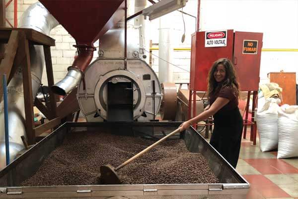
In this area, world-class coffee of the highest quality is produced. Here, we also find the sculptures known as the “Gordinflones (chubbies)”. Its famous restaurant – hotels, the “Laguna Verde” and “Las Ninfas” are also part of the attractions of this pre-Hispanic city.

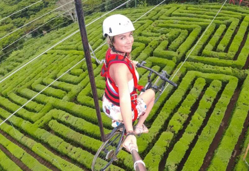
Here you can also experience adventure on buggies, canopy, hiking or you can practice enduring, and other extreme sports.

https://www.instagram.com/p/Bqqvs9iHoEA/?utm_source=ig_web_button_share_sheet

https://www.instagram.com/p/Bq0ao7mnkaq/?utm_source=ig_web_button_share_sheet

The Laberinto de albania (The Alabani Labyrinth) is the newest attraction in Apaneca as well as in the entire Ruta de Las Flores. Also Bike zipline at Albania cafe is an activity you can’t really miss

ruta de las flores tour, lady is posing in front a colorful mural located in Concepcion de Ataco, west El Salvador

Ataco: A city between cobbled roads of the Colony

Ataco is a beautiful coffee colonial city full of nostalgia, the atmosphere of the area transports one directly into the past. It is surrounded by mountains and full of magic, as its cobblestone streets, coffee fields, semi-perennial fog and craft workshops recreate the feeling of colonial El Salvador.

Ataco bases its economy on artisan production with natural fibers. There it is recommended to visit the Artisan Development Center to learn about the creativity and beauty of local artisans.

If you want to make the most of the Ataco experience (which means “Place of High Water Springs” in Nahuatl), you can visit its “Plaza Central” on weekend evenings and enjoy drinks and typical dishes alongside locals and Salvadorian holiday makers alike.

Coffee Plantation tours are available when visiting Ataco, visitors can learn the entire process of producing a world class cup of coffee from picking the cherries to roasting and cupping different types of coffee.

If you visit Ruta de Las Flores don’t forget to take a coffee tour, it will change the way you enjoy coffee.

ruta de las flores, learn how to make the best coffee in El Salvador, a girl doing coffee tour

Canadian tourist learning about the coffee production

Like any exotic tourist destination, it is necessary to take the corresponding forecasts to avoid setbacks, so keep in mind the following:

Facebook
Twitter
Pinterest
WhatsApp
airport-transfer-to-el-tunco

AIRPORT TRANSFERS 24/7

Our personalized service guarantees a stress-free start to your journey. We are available 24/7

Need Help? Chat with us